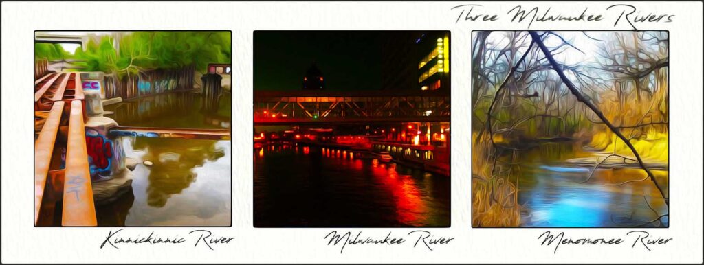
Three Become One
Water conservation is quickly becoming the most critical environmental issue for our next generation. Fresh water from our rivers and great lakes are a limited resource. With population growth, expansion of industry, and the increasing impact of climate change, more and more pressure is being placed on protecting our waterways.
“We are the sowers – the children will be those who will reap. To labour that future generations may be better and nobler than we are – that is the task without egotism and without pride. Let us unite in this work….”
– Dr. Maria Montessori
A Brief History on Milwaukee’s Waterways
Our journey begins on water. Milwaukee lies on a bluff overlooking a crescent-shaped bay. The Kinnickinnic, Menomonee and Milwaukee rivers flow through the city into the Milwaukee Bay, eventually joining lake water. The confluence of the Menomonee River, flowing west to east, and Milwaukee River, flowing north to south, is between the Plankinton Avenue the Water Street Bridges.
The Kinnickinnic River, known locally as “the KK,” twists and turns through the Southside of Milwaukee, eventually forming a small triangular bay and then connecting with the two other rivers around their southeast bend. From there, three become one. The rivers flow through the Milwaukee harbor estuary and the world-renowned Jones’ Island Water Reclamation Facility before draining into our deep bay.
Located on Lake Michigan’s western shore, The Milwaukee Bay was the most suitable natural harbor on the Great Lake. For thousands of years, First Nations people, both permanent and transient, called the region home.
They built communities on or near the rivers, marshes and the big lake. In fact, Europeans derived Lake Michigan’s name from the Ojibwe word mishigami, meaning “big lake.” Our First Nation communities respected the waterways, gathering the bounty of resources surrounding them. They only used what was needed.
You may never have noticed that Lake Michigan, one of the world’s largest sources of fresh water, is the only Great Lake held entirely within the U.S. border. Michigan ranks second largest by volume. Together, the five Great Lakes hold about one-fifth of the world’s fresh surface water supply, accounting for nine-tenths of our country’s freshwater. All combined, the five Great Lakes hold about six quadrillion gallons of water. That’s 15 zeros, for those who’re counting!
If you‘ve lived in Milwaukee for any extended period of time, you have likely noticed heaping piles of white salt covered with large black tarps along the heavily industrialized Jones’ Island while driving on I-794. The Great Lakes hold a special secret. They happen to rest upon what was once an ancient sea of saltwater. Time and geologic pressure have left behind a colossal deposit of salt, buried just beneath the Great Lakes basin.
This deposit has become the world’s largest salt mine in operation since 1959. Much of the salt stored on Jones’ Island real estate was claimed by the North American Salt Company. Since 1990, North American Salt has been owned by Compass Minerals. Joined by the Cargill and Morton, the salt companies number in three along the small shoreline peninsula.
Providing ease of transportation for both people and products, Milwaukee’s early population growth and economic development was largely made possible by the three rivers, our great lake and a deep, natural harbor. On a darker note, the water flowing out to the lake has also been a depository for much of Milwaukee’s water waste. Paradoxically, it also serves as the city’s primary source of fresh drinking water.
The Kinnickinnic River
Sometimes called the ‘forgotten river,’ the Kinnickinnic (the “KK”) is the smallest of three flowing through the Milwaukee harbor estuary. It measures in at roughly 10 miles long. The busy street now sharing its name with the river runs on an angle through Bay View. Once named the Chicago Road, it started as a trail natives used along the shoreline.
Kinnickinnic is an Ojibwe word of Algonquian origin, meaning ‘all mixed up.’ Like its name, both river and trail have experienced an all mixed up history, too. Exactly what was all mixed up along the original trail? Historical record points to a mixture of dried leaves, bark and tobacco. The tobacco might have been smoked by both natives and pioneers while traveling north along the shoreline of Lake Michigan.
Of Milwaukee’s three rivers, the KK is the most urbanized and densely populated. Treated more as a concrete drainage ditch than a valuable waterway, the KK was named one of the U.S.’s most endangered rivers because of the longstanding pollution problems tied to its industrial past.

In an effort to improve floodwater flows in the 1960s, the once heavily wooded KK River was lined with concrete and channelized. As with many environment projects such as these from the 1960s, it had devastating results on local ecosystems.
The channel deteriorated over time and this ‘lost river’ became highly contaminated. Filled with industrial runoff and defaced by graffiti, the KK remains “all mixed up,” but now with garbage and mucky sediment.
The KK River Line, part of Milwaukee County’s Oak Leaf Trail, follows a two mile stretch of an industrial corridor along the waterway. Divided by an active railroad line, on one side is an off-road paved multipurpose trail. On the other, remnants of the Midwest Rustbelt continue to noisily grind away.
Efforts have been made in recent decades to reverse the damage done to the river. In 2009, a multi-million dollar comprehensive watershed restoration plan got underway. The project’s goal was to eliminate 170,000 cubic yards of contaminated sediment.
As of 2020, 1,700 feet of concrete along the river has been removed. The KK continues to deliver a significant amount of contaminants to our drinking water. However, the waterway is steadily being transformed from a heavily polluted river back into something closer to what it was before White settlement.
The Menomonee River & its Valley
The Menomonee should not be confused with longer rivers named for the same First Nation tribe. The Menomonee River originates in Washington County wetlands and runs southeast for about 33 miles where it meets the Milwaukee and KK Rivers and three become one.
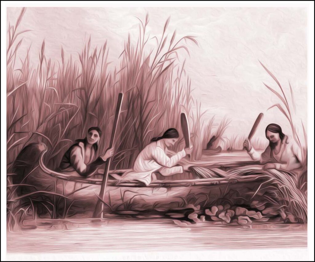
Glacial melt water formed the Menomonee River Valley over 10,000 years ago, a U-shaped land formation along the southern bend of the river nearing Milwaukee’s downtown. Once filled with fertile marshland, the Menominee tribe lived and hunted along the river and valley, using birch-bark canoes to fish for sturgeon. Their five clans (ancestral Bear, Eagle, Wolf, Moose, and Crane) originated at the mouth of the river.
French missionary Jacques Marquette was the first European known to have explored the area, arriving in the late 17th century. By the 1800s, fur traders and displaced Potawatomi had relocated along the valley and were now the primary residents. But soon, their marshland would be drained and replaced with smokestacks and several rows of railroad tracks.
Because of its easy access to Lake Michigan and other waterways, the Valley was at the center of Milwaukee’s urban development. Its was home to the city’s stockyards, rendering plants, shipping and other heavy industry companies providing city newcomers with thousands of jobs.
Cutting the city in half, the valley creates the boundary between the historic north and south sides. A handful of viaducts span the chasm, limiting access.
Similar to the KK, as Milwaukee grew into an urbanized city, a large band of the Menomonee River was channelized as it runs through the Valley. Over time, stream & wetland modification, industrial waste, runoff and construction site erosion degraded the water and habitat quality within the watershed.
The years leading up to World War I hinted at opportunity for African-Americans in the North. 1905 to 1935 was a significant period of migration into Milwaukee by African Americans. As German residents moved west, blacks migrated to the Northside. With a historically white Southside, the valley served as a racial divide during times of civil unrest. In the 1960s, Father James Groppi organized protests against segregation in Milwaukee. He led a number of fair housing marches across this symbolic divide. The 16th Street Viaduct has since been renamed in his honor.
In 1965, to offset flooding events, the Menomonee River in was deepened and lined with concrete just 3.8-miles upstream of the Milwaukee River confluence. A concrete removal project in Milwaukee was completed in 2016, naturalizing the river and allowing migrating fish to travel further up the river. The Hank Aaron State Trail is a 15.2-mile rail trail named for former Brave & Brewer Hank Aaron. Built on a former roadbed, the 14-mile paved trail serves as a continuous east-to-west connection from the lakefront, past American Family Baseball field, to the Milwaukee & Waukesha county line.
The Milwaukee River
Stretching from Fond du Lac County to the Port of Milwaukee, the Milwaukee River is approximately 100-mile long. The river cuts through downtown Milwaukee, creating the boundary between the east and west sides. Continuing southward, the Milwaukee River eventually joins the Menomonee and Kinnickinnic Rivers. Three become one before reaching the Port of Milwaukee.
The river provided native hunters an abundance of fish and attracted game such as deer and rabbits. The water became crucial to farming, requiring irrigation systems. Facilitating trade and diplomacy among local tribes, it also served as a means of transportation and cultural transference.
During the 1800s, summer bathhouses and swimming areas for the public were created along the river where Gordon Park and Kern Park now sit. This was also a popular spot for winter ice skating. For those fortunate enough to own property along the river, it became a sort of “in town up North.” Wealthy families bought land along the waterway, just north of downtown.
For milling and factory purposes, the first dam on the Milwaukee River was built in 1835 just downstream from the present day North Avenue bridge.
The effects on wildlife were desolating. Rapid industrialization and urbanization in the late 1800s came with devastating environmental consequences. All three rivers became a dumping ground for meatpacking plants, tanners, brewers, mills and manufactories. Businesses and residents filled the water with industrial and human wastes. In 1888, city leaders constructed a water tunnel between Lake Michigan and the North Avenue Dam, using fresh lake water to flush the toxins from the river.
At best, this was a short-term solution, as the lake water only pushed the standing pollutants farther south. Eventually the water was returned to Lake Michigan, creating an even larger water crisis. Adding to the burden, a garbage crematory was built on Jones’ Island in 1902, belching out black smoke around the clock above the harbor.
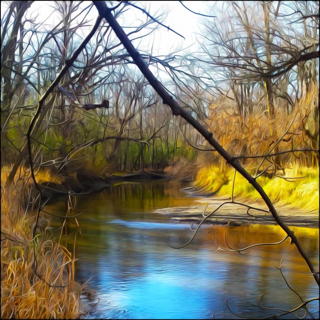
After more than a century of environmental harm, the North Avenue Dam was finally removed in 1996. As a result, the Milwaukee River Corridor to downtown has gone through a remarkable transformation. Odors and blight have lifted, while invasive plants have been removed for native vegetation.
When Three Become One
In the late 1800s, Milwaukee’s water was at its worst. Decades of industrial waste and neglect was taking its toll both on the three rivers and on the Milwaukee Bay. Poor water quality led to a tuberculosis outbreak, which was unheard of in a developed country. The city condemned the Jones‘ Island in 1914.
Local politicians devised a plan to clean up the three grossly contaminated and overused rivers and the lake’s drinking water. To protect against water borne pathogens, Milwaukee’s “Sewer Socialists” steered the construction of a wastewater treatment plant on the very north end of Jones’ Island. Construction of the Milwaukee Metropolitan Sewerage District’s plant on was completed in 1925.
With the help of researchers in the College of Agriculture at the University of Wisconsin, waste solids in the form of activated sludge became a source of fertilizer. The river sludge, once a terrible nuisance, was now being converted into nitrogen fertilizer, one of the most important components of soil.
Milorganite is a word made from the terms Milwaukee Organic Nitrogen, chosen through a winning entry in a National Fertilizer Magazine naming. Its roots dating back to 1911, the brand was popularized during the 1930s and 1940s. As a result of the success of Milorganite, the Jones’ Island plant has been designated as a Historic Civil Engineering Landmark by the American Society of Civil Engineers.
The water treatment facility steadily improved river water quality over the next few decades. Milwaukee began separating storm and sanitary sewers underneath the city to prevent the accidental release of untreated waste into waterways. Prior to this, the sewers were shared for water runoff and sewage. In times of heavy rain and flooding, tunnels often overflowed, carrying untreated human waste into the river and lake.
During the mid 1900s, the Milwaukee River once again served as a gathering place for family day trips and recreational activities. But, continued neglect and city waste would once again end the fun.
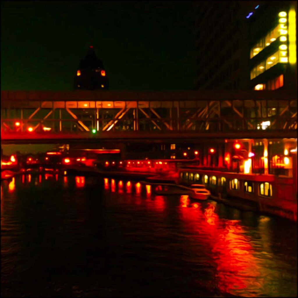
Befouled and malodorous waters recurred, leading to a widespread outbreak of cryptosporidium infection in the spring of 1993. It was transmitted through the public water supply. Discolored and beset with floating debris, the city’s three rivers remained a blemish on the city. Committing to changing the way Milwaukee viewed its waterways, Mayor John Norquist launched the Riverwalk Initiative. Plans for the downtown Riverwalk were drawn up in the early 90’s. Since then, the city has spent over five billion dollars rehabilitating the rivers.
Today, the rivers have once again become “a gathering place by the waters” for both Milwaukee residents and tourists alike. You would be surprised at just how many tourists Milwaukee hosts during the warm months. Having done rideshare driving over multiple summers, I quickly came to realize about half of my passengers requesting rides were from out of town. Many of which were visiting from Chicago.
The name “Milwaukee” is thought to be a mixture of native terms, deriving from the Algonquian word Millioke, meaning “good land” and a Potawatomi word Minwaking or “gathering place by the waters.” The city’s waterways have clearly proved to be the most crucial resource to its inhabitants over millennia.
Do you have more questions about Three Become One? Do you have a suggestion for another blog topic? Please send me an email with your ideas or experiences at grumble.services@gmail.com.
If you find this article helpful, please share it. Please join us, if you have yet to do so. Subscribe below and receive articles like this one in your email box weekly. Thank you!
Read More: First Nations: A Look at Hard History
All Rights Reserved • © 2024 Grumble Services LLC • grumbleservices.com
Three Become One References and Read More:
Milwaukee: A City Built on Water. John Gurda. Milwaukee PBS, 2018.
“Ancient Religions and Mythology.” Encyclopedia Britannica (2022). Tikkanen, Amy (Editor). The Britannica Group, Chicago IL https://www.britannica.com/. Accessed November 1, 2022.
University of Wisconsin Milwaukee. Encyclopedia of Milwaukee (2016). https://emke.uwm.edu Accessed November 1, 2022.